Friday, June 28, Day 67 (cont'd)
As we go through the outskirts of Spokane, Washington, we quickly get into farmland. This is wheat country, on the edge of the Palouse region, where dry land farming overtook cattle and sheep grazing to become the 4th largest wheat producing area in the US. Most are family owned farms, 2.2 million acres in all. But 80-90% of the wheat is exported, going to Japan, The Philippines, Taiwan, South Korea and Yemen.
When farming first started here, harvesting and threshing was done by horse team. Such a team in the 1920's required 120 men and 320 mules and horses. Teams moved from farm to farm as the crops ripened. Even with the advent of the combine, 40 horses and six men were needed to operate on level ground and this wasn't level ground! With the introduction of a harvester machine, by the 1930's, 90% of the wheat was harvested using combines. Tractors and large motorized combines have made this farming easier now. There are about 5,000 wheat farmers in the State.

We are passing the roads to towns very familiar to me - Medical Lake, Cheney, Sprague, Tokio, Ritzville, Washtucna... then Lind, Odessa and Warden. As a teenager, I went to all of these towns with the Rainbow Girls, an affiliated organization of the Masons.
The state produces about 120 billion bushels of wheat per year. Winter wheat, spring wheat, barley, corn for grain, alfalfa hay, dry edible beans, and hops are among the crops important to the region. Here's a field of beans.

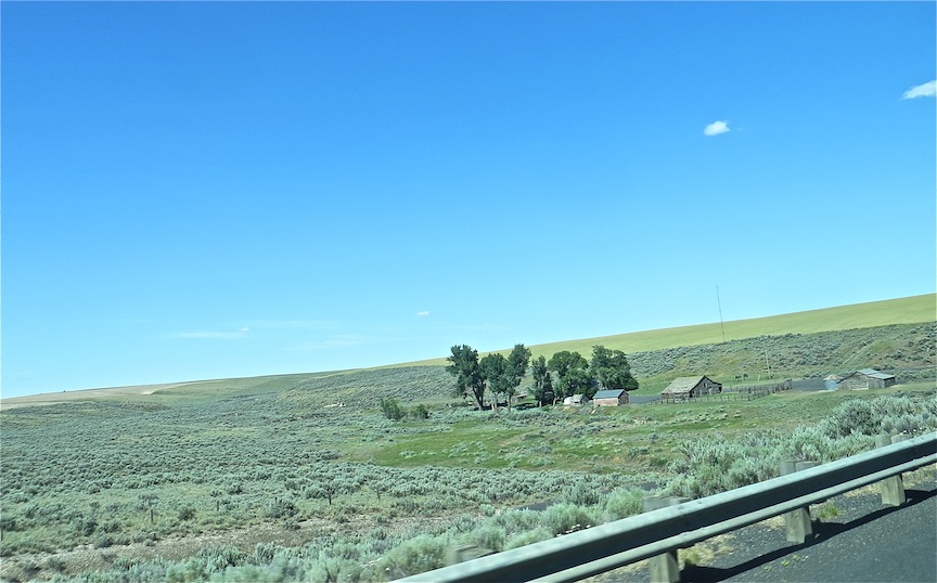
Outside the cultivated area is the way this land looked when I grew up here. Sagebrush, greasewood, foxtails, all low vegetation adapted to dry, hot country with little soil.

This is a good depiction of how a farm area looks in the surrounding natural vegetation.
Dust Devils! These are very common. Small versions of whirlwinds, or tornadoes, etc. The wind is always blowing here, and the farmers are in a constant battle to keep what topsoil they have.

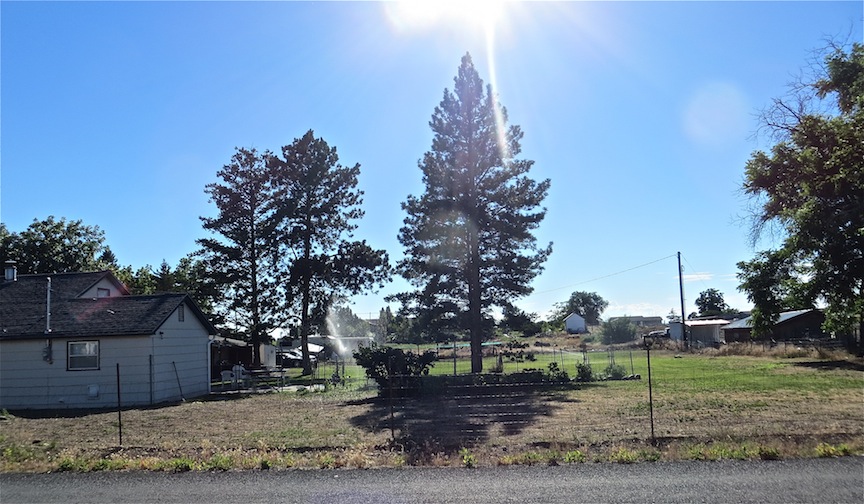
Almost every farm has a stand of trees that serves as a windbreak. Poplar trees are the most common ones used.

Along the road is evidence of caliche, a lime deposit (calcium carbonate) that binds the soil and makes it difficult to grow anything. You can also see, however, the massive sprinkler system on this land, making it possible to grow astounding amounts of crops. Farmers are constantly compensating for the shallow, poor soil.

This is an irrigation canal which is bringing water to this parched land. More about that later.

Corn is an important crop here. This corn is higher than other corn we have seen in our travels. It could be that it is just later in the trip, but my feeling is that it is doing better than most.


The picture above the signs was taken from the "fill" an earthen road built across the lake. This lake is like Devils Lake, in that it is endorheic. Remember that term? It means that is closed, with water coming in and none going out. Hence, what you see here is a large concentration of algae on the top of the lake on one side of the fill. As kids, we used to hold our noses as we went across the fill to keep from inhaling the strong smell of algae! Farm run off made it worse. Things have changed for a lot of the lake, though. More on that later.

This is the road leading to the house where I grew up. It is in an area called Cascade Valley. The names of the roads out here, Ottmar, McLaughlin, Dick, were all neighbors of ours.

This is the house where I grew up. Actually, it looks a lot better than the last time I came through here. It must have new owners. My family hasn't owned it since about 1966. The large tree to the right, a maple tree, is the reason my Dad wanted this property. The house on it was just a little shack, but after years building dams, railroads, tunnels, roads etc. out in remote, dry dusty no-name places, he just was so happy to find a place with a beautiful shade tree. The tree must have been at least 30 years old when we bought the place, so it's over a hundred now, and has lost a few branches. The house also had a beautiful lilac hedge, part of which was lost when an auto came through it. But remnants of it are still there. The road on the side of the house has been widened to accommodate the housing development taking place to the north. The road is precariously close to the base of the tree, and I am surprised they didn't take it out.

We had an acre of land, and grew just about every type of fruit and vegetable imaginable. It was originally an apple orchard, We grew apples, peaches, pears, plums, grapes, raspberries, blackberries, gooseberries, rhubarb, lettuce, tomatoes, corn, onions, carrots, beets, radishes, cucumbers, and a myriad of other things, which we canned and used throughout the year. We also raised chickens and had a cow for meat. It looks pretty barren now, and the pine trees have replaced some willow trees I started literally from twigs. My father had a blue spruce that he hung Christmas lights , but it has been removed. Amazing what changes you see in 60 years!!! :)
I had a wonderful childhood.! I rode my bike everywhere, and although we were pretty far from town, there were two other girls my age who lived nearby. We participated in Camp Fire Girls, and were driven to town for all of the school activities. During the summer, we didn't see anyone else until school started again. But, I am still in touch with a lot of my childhood friends.

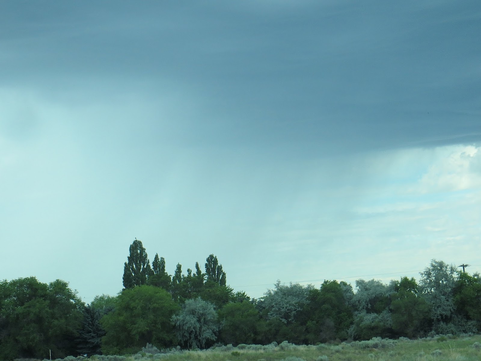
John and I parked our camper out by the lake in an RV park I was not familiar with. It wasn't too long after we got there that the clouds gathered,

Sure enough! Look at our weather pattern. See that rain hovering over the State of Washington? That's us! I don't ever remember having rain in the summer!

See that numeral "2?" That's Moses Lake.

Sheets of rain are in the distance.
This is the swimming area at what is now called Blue Heron Park. This is where I was to learn to swim. At that time, the water was so green and smelly, I wasn't about to open my eyes, and I never reached the correct marker, since it's hard to do it with your eyes closed. Those reeds tell me that the water is still stagnant. The town pool was off limits to me because of the polio epidemic and fear of getting it. Good thing there was lots to do besides swim!
That land in the distance is Cascade Valley. They have created some egresses for the lake water, and people have built homes, boat docks, etc. all around the lake. When I was growing up, nobody built a house on the lake! The town looks very prosperous now.

As I walked out on a new dock and looked into the water, I immediately recognized these weeds growing up from the bottom. They always wrapped around your legs when you were trying to swim, kind of like swimming in a kelp bed. So some things haven't changed!

Big drops of rain started to come down and I had to hurry to the camper. See those streaks? They really were big drops! That's not a time lapse....

There is a farmers market in town this morning, and if the rain lets up, we are going to take a look.

No comments:
Post a Comment