Saturday, December 14, 2013

Retrospective


We had a wonderful trip, one with life long memories, but as we got closer to home, we reflected on the journey and shared our thoughts.

This trip was so much different than the one we took to Alaska.  On the Alaskan trip, once we crossed the Canadian border, we had virtually no destinations or obligations in mind, other than a short reservation in Denali and meeting a cruise ship in Skagway.  We also had a goal of being on the Arctic Circle on the longest day of the year.

On this trip, we had obligations from the start!  As people found out we were traveling, they asked if we were headed their way.  Once we said yes, they wanted to know when we would get there, how long we would stay, what we wanted to see and do, etc. There were many people we wanted to see, some we'd never met like relatives in North Carolina and Virginia.  We wanted to see old friends, see where people had relocated. etc.

We also had our calendars marked for our granddaughter's graduation in New York in late May, but then added in a family rendezvous in the Puget Sound area of Washington State for the 4th of July.
Our plans to go to the Canadian Maritimes quickly dissipated as we needed to head across country. We loved every visit we made, but at the same time, we simply didn't have the time to linger at places we would have liked to explore.

Our trip to Nebraska took us almost half way BACK across country, although we wouldn't have made the trip without stopping to see my sister.

Would we do it again?

We're glad we did it, but no, we would not plan a trip that extensive, with that many plans.  Our next trips will be much shorter, with specific destinations and plans to stay longer at places we think look interesting, and when the mood strikes.

We had two small glitches in our otherwise perfect trip.

One was a problem with our camper.  When we got to Nebraska, John took the camper off the truck, and when he started to fill the water tank, he heard popping sounds.   It was the rivets that held up the flooring on the camper.  Kind of like the Titanic, they just kept popping!

He was able to reinforce the bottom with steel bars, and he put a minimum amount of water in the tank.   A trip back to the Lance camper factory in Lancaster, CA after we got home resulted in a new bottom, and we are good to go.   He was told at the factory that it was simply the result of wear and tear plus weight.  So we have made a vow to pack lighter the next trip!   And not put too much water in the tank.

And last, but not least, while we were in Nebraska, John went on line and discovered that our utility bill had skyrocketed at home.  He called SDG&E and was told it was the gas bill, and it was likely there was a hot water leak somewhere.  Our housesitters couldn't find anything, and neither could our son until he pulled up a trap door in a hallway, and water and steam whooshed out!  The housesitters were able to move out immediately, and the water was shut off until we got home and a plumber repaired the line. 

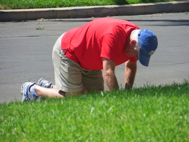
When we drove up, the first thing John did, without even entering the house, was go immediately to the street to take a look at the water meter.


His body language says it all.  We did indeed have a massive sudden leak that did major damage to our house, damage that would take two and a half months to repair.

But that's a story for another day!  It didn't ruin our memorable trip, and although we arrived home a few days earlier than we had planned, the last leg of the trip was through very hot, dry dessert, much of which we'd traversed before, and which presented nothing we wanted to stop and see.

Thus ended the journey of the Traveling Roadmantics! 


Post Script: Pigeons and Doves

When we were visiting with our friend in Tennesssee, he told us of a man who had gone dove hunting in South America.  There were so many birds, he went for a Guinness Book of World Records.  With the help of several men, he shot doves from 8 in the morning until 8 at night.  Those helping him reloaded the guns and actually cooled the barrels off in buckets of water.  At the end of the day he had shot 3000 doves!

This took me back to my Passenger Pigeon story and the rapid extinction of that species, in part because of overzealous shooters.

When I looked it up, I discovered a great many websites advertising dove hunting, primarily in Argentina. They are after the Eared Dove, a close relative of the Mourning Dove.  Sound familiar?
Here's what I found.


Eared Doves provide the last big-bag shooting experience in the world. There are estimated to be more than 23 million of these doves in the fields around Córdoba in northern Argentina, and recent estimates put the figure in the 32 million range. It is not unknown for a single gun to shoot 1000 birds in a day.
The scale of this wing-shooting recalls the numbers of Passenger Pigeons taken by North American gunners in the 1800s. That hunting pressure brought the Passenger Pigeon to rapid extinction, but the Eared dove seems to be more resilient. Indeed, as with the Passenger Pigeons, Eared Dove populations in Argentina and Bolivia sometimes "darken the skies". Thus, it seems that populations on the sporting estates of Argentina are holding their own, with the birds breeding four times a year and thriving on the vast areas of grain, some grown for their benefit, most of it on commercial farms which are happy to support the dove shooting.
One Estancia estimates that there are one million doves on its estate alone. The season extends is year around. .
The Eared Doves  do not migrate, and the enormous flocks are described as flying constantly between their roosting woods and the open fields. In the Cordoba region in Argentina the Eared Doves are known as palomas doradas because of the shining feathers sometimes present in their plumage.
Locals in Bolivia atest that Eared Doves, which they call  totaky were quite rare in the region just a couple of decades ago, a testimony not only to the resilience of the species but to the huge impact that the newly-created large feeding grounds have on dove populations.

Thus say those who promote the hunting.  But, all good things come to an end, and with this type of hunting, surely the doves of South America are destined at some point to suffer the same fate as the passenger pigeon did in North America.  


Post Script: The Ten Most Visited National Parks

The Ten Most Visited National Parks

Who knew?

We were surprised that the Acadia National Park in Maine was among the top ten most visited National Parks in the U.S.  I hadn't even heard of it until we were about to visit there.  So, of course, I had to find out what the top ten were. Here goes:

Great Smoky Mountains National Park     9.6 million visitors last year
Grand Canyon                                           4.4 "   "
Yosemite                                                    3.8
Yellowstone                                               3.4
Rocky Mountain                                        3.2
Zion                                                           2.9
Olympic                                                     2.8
Grand Teton                                              2.7
Acadia                                                       2.4
Cuyahoga Valley                                      2.3

Wonder why places like Niagara Falls aren't on here?  It's because Niagara Falls is a State Park and
doesn't qualify as a National Park.

Just for the record, there are lots of federal designations, to wit:

National Park
National Monument
National Preserve
National Historic Site
National Battlefield
National Cemetery
National Seashore
National Lakeshore
National River
National Parkway
National Trail

I think we saw at least one of each on our trip!

Post Script: By the Shores of Gitchie Gumee on Michigan's Upper Peninsula


The Song of Hiawatha and the Upper Peninsula of Michigan

 One of the things we noted as we were traveling the Upper Peninsula of Michigan was numerous references to Gitchie Gumie  and Hiawatha.

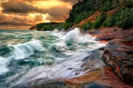
This upper Michigan peninsula, and in particular, the Pictured Rocks on Lake superior near  Munsing, was the site of the poem.   We never got to see these rocks, but have definitely put the Upper Peninsula on the list of places we would like to visit and stay longer.  These pictures come from other sources


Henry Wadsworth Longfellow  published his poem, The Song of Hiawatha  in 1855.  It is credited with being  the first American epic poem composed completely with North American materials and no European influence.  The meter he chose, however, was a rhythm familiar to those of Finnish descent who made up a great portion of the Upper Peninsula. And still do! 

Longfellow mixed a lot of different Indian traditions to create his poem.  He relied heavily on a man named Henry Schoolcraft who was an Indian agent, and whose name we also ran across frequently.   The Ojibwe Indian’s oral traditions greatly influenced the poem, and 50 years after its publication, one of Longfellows daughters made a pilgrimage to the Pictured Rocks area at the invitation of the Ojibwe Indians, who considered her father to have preserved their history. The poem gave them a great deal of solace in the loss of their culture.   Ironically, Longfellow himself never saw the area!  Here’s the invitation that daughter  Alice Longfellow received written on a piece of birch bark. 

“Ladies: We loved your father. The memory of our people will never die as long as your father’s song lives, and that will live forever. Will you and your husbands and Miss Longfellow come and see us and stay in our royal wigwams on an island in Hiawatha’s playground, in the land of the Objibways? We want you to see us live over again the life of Hiawatha in his own country.” 

You can read her story here: http://www.mynorth.com/My-North/December-2008/The-Trip-to-Hiawatha/index.php?cparticle=1&siarticle=0#artanc


The Song of Hiawatha was an immediate success.  It has been recited by countless school children, and has been the subject of plays, movies, symphonies,  paintings, etc.  and it endures to this day. 

By the shores of Gitche Gumee,
By the shining Big-Sea-Water,
Stood the wigwam of Nokomis,
Daughter of the Moon, Nokomis.
Dark behind it rose the forest,
Rose the black and gloomy pine-trees,
Rose the firs with cones upon them;
Bright before it beat the water,
Beat the clear and sunny water,
Beat the shining Big-Sea-Water.


Post Script: Laurine Murphy's Restaurant: "Another Popover, Miss?"

One of the childhood memories that John relayed to us during our tour of Long Island was going to Lauraine Murphy's restaurant with his grandparents.   This was a big deal!  It required getting all dressed up, and the food was truly 1950's Americana.  The children were expected to act like adults, and  for girls, the dress code was those full dresses with the stiff crinoline slips, tights and patent leather shoes.  I'm sure the boys wore  coats and ties.  The waiters treated the children like adults as well, making them feel "grown up", but nervous, because table manners were expected to be impeccable.  And everyone, including the grandparents talked to the children like adults.  Everyone in the restaurant was dressed up!  Minks, hats and gloves were not out of the question for grandparents, especially Nana Blake.   And of course, Dad Blake would have been in a suit.  


Maybe the most favorite things about Laurine Murphy's was the "popover girl", who would come to each table with an enormous basket with a linen napkin lining, filled with hot, fresh popovers.  She wore a gingham dress and would walk around the restaurant saying, "Popover?" and who could resist?  You could have as many as you wanted -- but only one at a time!  

For those of you who have not experienced a popover -- it's worth your while to seek them out!  There are special popover pans and mix you can buy, or you can make your own - there's a recipe attached here.  You can also make them in muffin tins, but the secret to a great popover is to warm the milk and warm the tin before pouring in the batter.  And make them in a very hot oven.


The pop over was very light and fluffy with a hollow center, just right for melted butter and your favorite jam.

Laurine Murphy had a more famous sister, Patricia Murphy, who had a number of restaurants called the Candlelight Restaurants and she wrote a cookbook called "Glow of Candlelight."  Her concept was probably a forerunner of a chain, but every child who remembers going to Patricia Murphy's thought it was the only one.  

I will include a menu here from Patricia Murphy's restaurant.  An original from Laurine Murphy's has proved to be elusive, but they were probably similar.  


And, here's a recipe, also from Patricia Murphy's, but I'm sure that, as sisters, they shared their secrets! 

PATRICIA MURPHY'S POPOVERS

PARAPHRASED FROM PATRICIA MURPHY'S AUTOBIOGRAPHY

The New York Daily News printed the recipe for their popovers in the September 26, 1984 edition of the paper.  This recipe makes 6 large or 9 small popovers.

Butter or pure vegetable shortening
1 cup sifted all-purpose flour
1/4 tsp salt
2 eggs
1 cup whole milk
1 Tbs sweet butter, melted

BEST IF YOU HAVE A POPOVER PAN, BUT A MUFFIN PAN WILL DO.

Put 1/3 tsp of butter or shortening in each cup in a 6 or 9 cup muffin pan or Popover Pan.  Put pan in preheated 450 degree oven for 5 minutes while making batter.

Sift flour and salt into a bowl.

Beat eggs with whisk, add milk and butter, and sift in flour, beating only enough to make a smooth batter.  Fill hot pans 1/3 full of the mixture. 

Bake for 30 minutes at 450 degrees, then reduce temperature to 350 degrees and bake 15 minutes longer or until firm, brown and popped.  Keep oven door closed while baking.

Serve warm from the oven.  


Post Script: Mello Rolls


On our trip out to Jones Beach on Long Island, John was describing to us a delicious ice cream cone he and his sister Susan used to look forward to on their day long jaunts to the beach.   He remembered them as being called "Neller" rolls.  He described them as being a cylinder of ice cream-vanilla, chocolate or strawberry- that came separate and were inserted into a rectangular cone.  They were sold on the boardwalk and boy, were they good! The perfect treat on a long day at the beach with the sun beating down, the sand blowing in your face, the waves rolling ashore…


It took a little doing to find "Neller" rolls because, the real name is Mello Rolls and they were made by Borden's.  Close - for the memories one has as a little kid. Most kids from that era (1950's, 60's) thought that Jones Beach was the only place in the world you could get a Mello Roll.  


Thanks to the searching of our daughter-in-law Maria, here's the "scoop", as they say!

The customers at Jones Beach had to buy tickets in 5c 10c or 25c denominations from a cashier.  The ticket colors changed each day so people couldn't redeem stolen or lost tickets.   Later , the concessionaires employed "line girls" who took the tickets in front of the counter so the servers couldn't "palm" tickets.   (Those New Yorkers - always thinking! )

The advantage to the seller was portion control - no relying on some teenager to make extra big scoops or put on extra ice cream for his friends. 

Also, the server never touched the ice cream.  The customer just had to grab the ends of the wrapper and unroll the ice cream while it was still on the cone.  AND, it didn't hang over the edge, so no dripping and sticky hands  and arms (or other parts of the body) as you would get from a regular cone.  

One  person relayed on the Internet how he tried to tell his grandchildren about Mello Rolls.  They were in disbelief as he told them that the cone was the size of the cardboard in a roll of toilet paper, and the ice cream was a hard cylinder that you had to unwrap yourself.  Another remembers dropping the ice cream on the boardwalk trying to get it unwrapped, but picked it up, put it back in the cone and ate it anyway! 

Mello rolls weren't unique to Jones Beach.  Others remember being bribed by their parents to behave in the car on their way to see the grandparents -- the bribe of course being a Mello Roll at the end of the long ride.

Another said he lived in the Bronx and "Chubby" used to come around and sell them to his mother for him and his brothers and sisters.  One man remembered that Mello Rolls were a special treat that could only be afforded once in a while. The costs seemed to have ranged from 7c to 10c. 

Those writing on the Internet had Dads who managed the concession, or worked in the Mello-Roll factory, or sold them!   First hand knowledge. 

There seemed to be a lot of remembrances of Mello Rolls by people in Canada.  And everyone says  the taste beat anything on the market today -- richer and much much creamier. 

Alas, Mello Rolls stopped being sold sometime in the mid 70's.  As one nostalgic person put it, "the day 
I was told they no longer sold Mello Rolls was the day I lost my innocence."


The End of the Journey!


Wednesday, July 24, Day 93 - LAST DAY

There is an area just west of Yuma called Felicity and we have been by it many times.  It always looks like this lone chapal on an artifical hill in the middle of nowhere.

However, in looking it up, it turns out there is this huge granite museum on the flat behind it.   Not a museum to granite, but the history of the world carved in granite! You can see the chapel at the top of the picture.  

There is a large 15 foot sundial, and a chapel with a Michalgelo painting from the Sistine Chapel in it.

The guy who is making this is a Korean War Vet and bought thousands of acres out here to create what he terms an "entertaining" concept.   Guess we'll have to stop next time! 


Here we are rushing past Dateland, the place where we spent our first night on the road when we started this trip!

And the Chocolate Mountains are now ahead of us.


Here's an RV park like the one we stayed in the night before.  Charming!


When we passed through Yuma, we caught a glimpse of what's left of the Colorado River, once it gets this far South.  Don't get me started on that topic. :)


And there it is, the California border!


We pass the Imperial Dunes, a vista complete with one of our canals carrying Colorado River water to
the Imperial Valley.


You kind of expect to see camels coming over the rise. Instead, it will more likly be an ATV.  Or
a Border Patrol Wagon.


And out through the Imperial Valley and El Centro - with a temperature of 105 degrees. Imperial Valley has about 164,000 population, and they grow alfalfa, lettuce, sugar beets and carrots out here , to name a few crops.


I've always wondered what is being mined out here.  As John says, I'll have to Google it!


It's just such barren ugly land out here!  I'm sure there are those who beg to differ…


And what's left of the town of Ocotillo Wells.  The entire town is in the picture, flanked by massive wind turbines behind. Those who live here have greatly protested these wind turbines, and they are pretty ugly, but our energy has to come from somewhere, and these desert canyon areas, where the wind blows constantly, is a logical place to generate lots of electricity.


And as we come up over the Tecate Divide, we began to see the rock formations unique to San Diego, caused by boulders being dropped by the most southern of the glaciers during the ice age.


Off on the hill is the Desert View Tower, which is a San Diego institution, but where we have never stopped.  We are always just leaving San Diego, or are anxious to get home.  Actually, it looks pretty interesting. It was built in the 1920's by a land developer for nearby Jacumba.  In the 1930's another guy made numerous rock sculptures of animals, folk art style.  We'll keep this on our list of things to see!


We are now officially on the Kumeyaay Highway, named for one of the prominent Indian tribes in the area.  San Diego County actually has more Indian tribes than any other county in the US.  Some have built casinos nearby, and shopping outlets, and names of tribes I've never heard of before now have signs designating their reservations along the highway into San Diego. 

We also pass more familiar signs for  towns like Jucumba, Descanso, Pine Valley, Alpine, El Cajon….


And then -

After 93 days and 13,094 miles, WE ARE HOME!  It has been quite an adventure.

Thanks for traveling along with us!


Arizona Part 2

Tuesday, July 23, Day 92

We headed down the highway marveling at the beautiful landscape.  No wonder Arizona can devote a monthly magazine to its beautiful scenery.


Maybe if we don't look, those clouds will go away!
This has to be part of that Mogollon Rim of limestone and sandstone.

All of a sudden we came to the Salt River Canyon.  It was breathtaking!  The river has cut such deep gorges, and the recent storms has washed away a lot of sand and soil.


We traveled on steep hairpin turns to get to the bottom of the canyon and crossed a bridge.  My sister Beverly remembers pulling a trailor down this grade and just barely keeping it on the road!

Hard to imagine how much silt this water contains.  
Climbing up the other side, we are on the San Carlos Indian Reservation. It's a story of corrupt Indian agents who kept or sold the provisions meant for the Indians.  Some Indians were sent to reservations in Florida.

And several tribes were eventually consolidated onto this reservation, despite them being from different backgrounds and customs. I guess all Indians looked alike to the government and agents!   The reservation today has about 9300 people and 3000 acres.  They are among the poorest Indian tribes in the US with 60% living below the poverty line and 68% unemployment.


We are headed into mining territory.  Copper is big out here and you can see the mines on the far hills.   The terraced area in front has already been mined.

We passed through Globe, population 7500, probably mostly miners, although they are trying to develop a tourist industry.


Here's where we are.


This is copper mining in Superior Arizona.


Then we passed through these rock formations on windy roads…


And found ourselves in territory looking more like Phoenix.  We watched the temperature rise, 102-4-5-6 and we headed around the Superstition Mountains, and Silly Mountain.


We got through Phoenix in rush hour, watching the temperatures hold steady at 106 degrees.  And we stoopped for the night just the other side of Phoenix in Buckeye.  It was a huge RV parking lot, but nobody was there, because it's for the Snow Birds who come in the winter.  You could see the heat rising from the totally asphalt RV campground.  And it was 97 in the camper.  There were no green trees, no grass, etc.  We always hate it when we get close to the end of our trip in a place like this.

Wednesday, July 24, Day 93

 We were out at 8 am, and the temperature was already 90 degrees!  We passed through Gila Bend and we saw some incredible solar projects along the road.  This particular one is 400 acres and has 170,000 "single axis tracker modules", making enough electricity for 8000 homes.  And it is one of four such solar plants in the immediate area!


Couldn't resist this picture of Sentinal, AZ.  What you see is the extent of it.  The middle of no where indeed!

The terrain has flattened out and we can see the mountains in the distance. I couldn't find a name for the mountain range, but there are lots of individual mountains out there.