We pass the Musselshell River, which is just a trickle. It flows north almost 500 miles counting its tributaries. In 2011 it flooded, four feet above stage at 14.16 feet. It twists and turns through wind swept, wide-open and sparsely populated prairie. It is not a big river. But I understand it is great fishing. It was named by Lewis and Clark for the freshwater mussels lining the bank. The local Minnetare people had given the waterway a similar name.
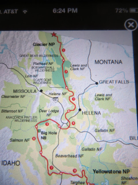
We are going to stay in Great Falls tonight. We pass (quickly) by a town named Winnett, with a sign saying "Go ahead and Blink, We're Still Here." We have climbed about 1000 ft. since we entered the state at Glendive, where it was 2078 elevation. Winnett is at 2952.
This is the Missouri River in Great Falls. It was named for five falls that Lewis and Clark had to portage. It was a 10 mile stretch that took 31 days! Now, each of the falls has a hydroelectric dam on it.
The Missouri flows 1,029 through the state of Montana, and is its longest river.
This is also home to the shortest river in the world, the Roe River, which rises from a spring and goes
200 feet into the Missouri River. It competes in the Guinness Book of World Records with a river in Oregon, the D River, which kind of fudges on its length because of the tides. At any rate, the latest Guinness Book has eliminated mention of this record.
Great Falls is also home to a huge military complex, which includes Malmstrom Air Force Base, home to 341st Missile Wing and the Air Force Global Strike Command. It also houses an Air National Guard Base with F-15's, which flew overhead And there is a US Army Reserve and an Army National Guard Base.
Great Falls is also home to the Charles W. Russell Museum, which displays many of his paintings and drawings. I am sorry that we don't have time to visit it. Oh well, you have to have something to see next time!

Thursday, June 27, Day 66
We were only out of Great Falls a short period of time before the foothills of the Rocky Mountains came into view. We actually missed a turn due to construction and had to go about 30 miles out of our way before we could make a U-turn and get back on Route 200.
The ground shows these deep arroyos, and long vistas with the Rockies in the distance.
There is a little snow on the mountains and only a small amount of civilization before we head through those hills. Everything is laid back here. In Lincoln, Mt. a big black dog crossed the road in front of us. But, he was in the cross walk, the only one in town, and he was headed to the library. We wondered what happened when he got there...
And then just long vistas appear. The herds of Black Angus we see are part of the majority breed in the US. They originally came from Westertown, Fochabers, Scotland in 1873. They are carefully bred and the herds are constantly improving. There are 317,000 registered black angus in the country, and Montana has the most at 32,300.
You can already tell that these mountains are taller and younger than the ones we saw in the Judith Basin, more jagged and rugged. They kind of beckon us west.
Ranching was one of the first industries in Montana, as ranchers supplied beef to the mining towns. They relied on the open grazing range, moving their herds to fresh pastures. Montana has roughly 30 million acres of grazing land, and once had over 100 grazing associations. There are now 27 state grazing districts which are managed for the cattle industry, which is Montana's largest. industry.
Many of the ranches are still owned by descendants of the original families from the 1860's.
The vistas here are just outstanding. This is the Blackfoot River.
We have finally reached the Continental Divide, Rogers Pass, at 5610 feet elevation. From here on, the rivers, streams, creeks we pass will be flowing west or north.
This is also big timber country and we are seeing lots of logging operations. Logging first started in 1845, and there are now 400 logging companies in Montana alone. The railroad had a lot to do with creating the logging industry. They needed timbers for the railroad ties. And farmers needed to clear the land. Between 1890 and 1900, an average of 6400 acres were cleared every day for farmland. Yes, 6400 PER DAY.
We came upon a long wait for road improvement. It's weird because there is no equipment out here and nothing is going on. The only thing we can think of is there is loose gravel and the pilot car keeps the speed down to avoid throwing rocks at oncoming cars.
We crossed the Blackfoot River, which runs alongside the road. It has a braided look in some places, sandbars, very clean water. There are many creeks running into it. There are foothills and meadows. An Eagle flew overhead. Signs say Bighorn Sheep may cross (they need 2 miles)


No comments:
Post a Comment