Wednesday June 5 (cont'd)
This island was discovered in 1604 by Samuel de Champlain. Four centuries later, it is pretty much the same. It was declared a national park by President Woodrow Wilson.
From 1915-1933 John D. Rockefeller, Jr. financed designed and directed a network of about 50 miles of carriage trails throughout the park. When the fire destroyed so much in 1947, Rockefeller financed much of the restoration of the whole island.

There is a 27 mile loop road around the park, and the first road takes you to the top of Cadillac Mountain. The views are so different on each side, and on this beautiful day, they were breathtaking.

The area was formed by sediment, then fired by volcanic activity, which created the granite, and then glaciers. You can see the glacier activity here. This is Eagle Lake.


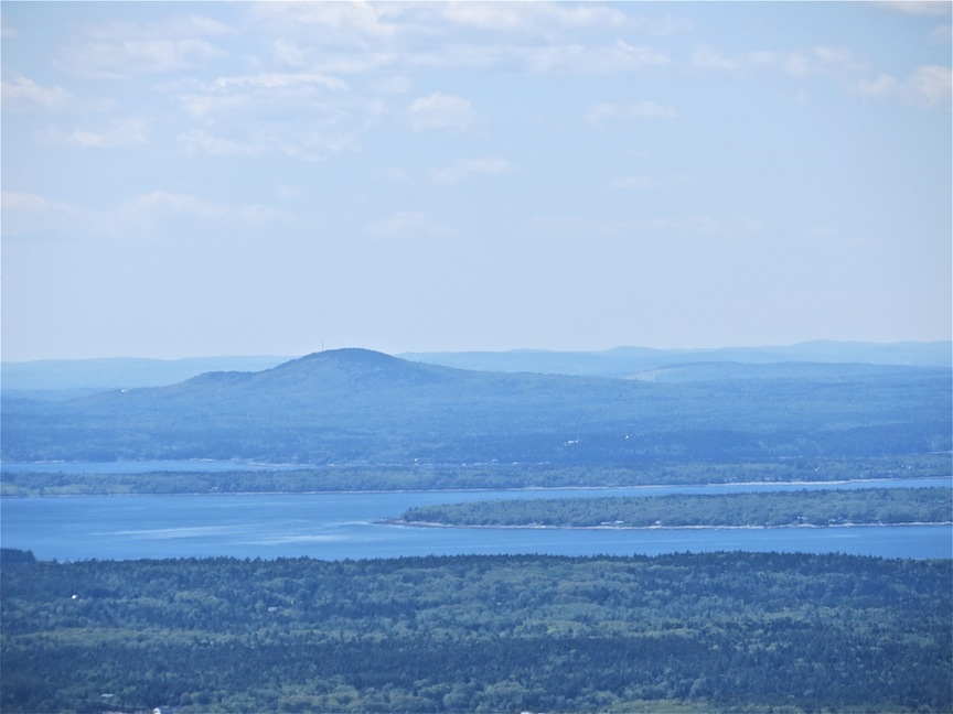
At the summit, which is only 1530 feet, you can get a good view of Bar Harbor and the surrounding islands.
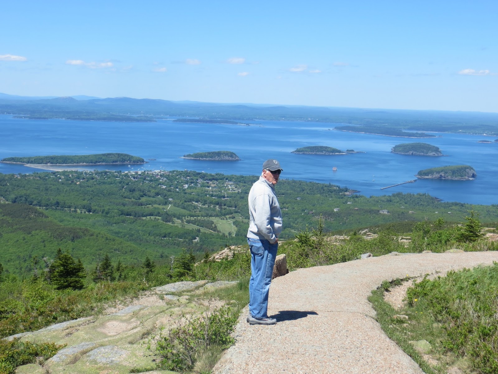
This schooner is one of the sightseeing boats. Amazingly, I got this shot with my Canon 20X lens.

If you look at the four islands directly ahead, you will see that same schooner in the middle. I got both of these shots from the same place!

And this is Bar Harbor.


John holds a piece of the pink granite that makes up this mountain.

Here's a good look at the granite, covered with lichens and mosses.

And the top of the mountain, all granite.


Down on the lower roads, we go through some lovely stands of trees.

At one point, we spotted two beaver dams. I couldn't get both in the picture and still have them visible.

This is the coastline that Maine is so famous for.

At an area called Thunder Hole, you can walk down and look at the rock where the water comes up and makes a loud booming sound. The height of this activity is at 5:30-6:30 tonight, but we got the idea! It was already loud.


This is one of the carriage bridges Rockefeller created. We didn't find out until we were in the park that there are five of these low clearance bridges on the road, and that "advance planning" was necessary for RV's. It says so on the map after you have entered the park and paid the entrance fee, and there is no place to turn around! There was one we couldn't go under, but it was on a side road.

All in all this was a beautiful day. We are headed to the last stop which is Jordan Pond.

No comments:
Post a Comment